
Gin Flat Pilot Study-Yosemite National Park
The Gin Flat pilot project involves the deployment of 10 ultra sonic depth sensors. The research site is located in Yosemite National Park at Gin Flat, located along Tioga Road at 2130 masl. (7,000 ft.).
The overall aim of the measurements is to understand spatial distribution/variability of snow depth across varied and complex topography. This small-scale pilot study in an open forest is a necessary step in developing proof of concept and in testing the deployment of equipment in a distributed network based on topography. The manual and automatic snow-course networks in the mountains of California and other parts of the Western US provide accurate measures of how much snow is at their locations, however the network is sparse. While this sparse network of sites have proven historically to be good indices of streamflow, they do not provide an accurate measure of how much snow is on the ground across a region.
The specific goal of the study is to test the ideas on consistency (or lack thereof) in snow distribution in the vicinity of a typical snow course/SNOTEL site in the Sierra Nevada. Gin Flat is an ideal location for testing these ideas of snow distribution because the California Department of Water Resources and the USGS operate a SNOTEL site and other advanced instrumentation for snow measurement.
The ultimate goal of the Gin Flat Pilot study is to use the results to develop strategies for applying sparse point measurements over larger regions to estimate the spatial properties of snowcover.
On December 8, 2003 10 ultra sonic depth sensors were deployed and began logging snow depth and temperature data in a 5 km 2 study area (see Figure 1). The spatial array of 10 depth sensors are mounted on 3 meter (10 ft) masts (See Figure 2). The research site is located in Yosemite National Park at Gin Flat, located along Tioga Road (Highway 120) at 2,130 meters (7,000 ft.).
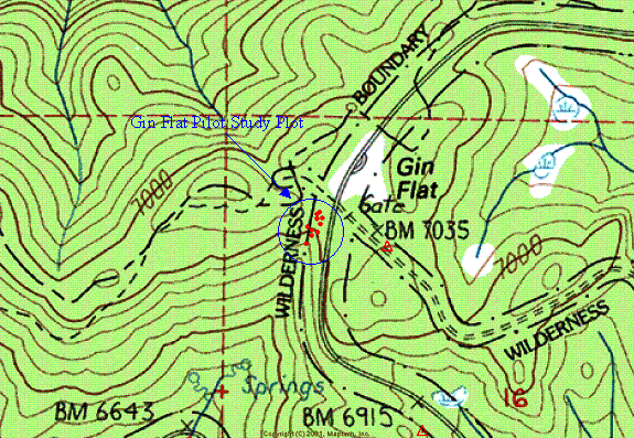
Fig 1. Topographical map of Gin Flat and the corresponding study site. The spatial array of 10 ultra sonic depth sensors are are located just inside the wilderness boundary and to the west of Hwy 120.
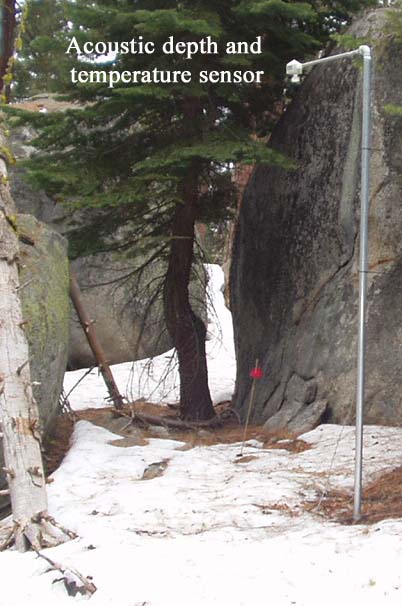
Fig. 2. Ultra sonic depth sensor mounted on a 3-meter (10 ft) mast.
Periodic downloading of the data will occur monthly, as well as a snow survey performed at the study site (See figure 3). The downloading of data and snow survey will correspond with the timing of the National Park Service snow course survey at Gin Flat. These snow survey campaigns will occur at the end of each month beginning in January 2004 and ending in May.

Fig 3. Recorded snow depth measurements from the 10 ultra sonic depth sensors, as well as temperature between December 8, 2003 and January 27, 2004.
Additional Pictures:
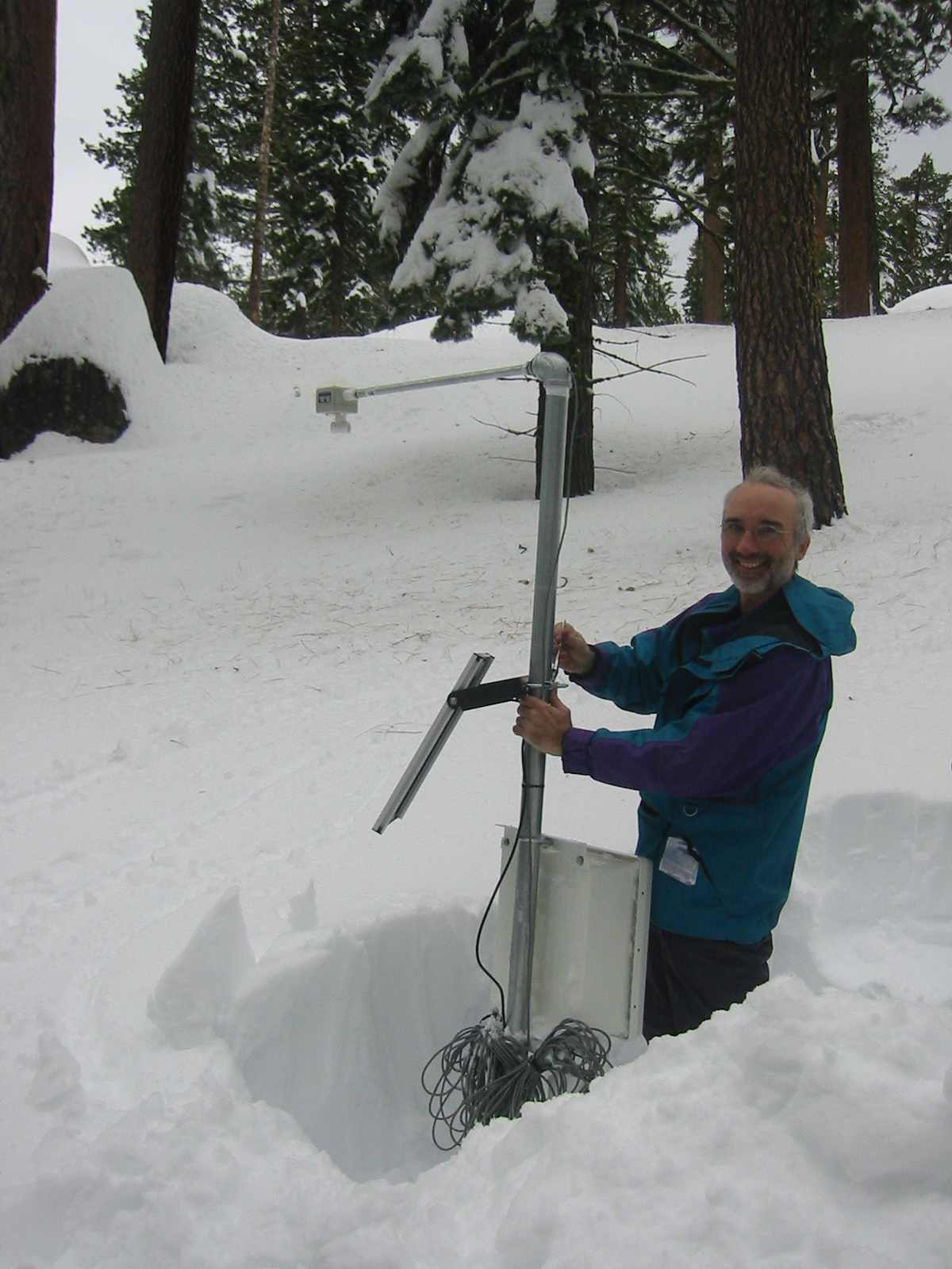
Roger Bales making adjustments to the solar panel and wx proof enclosure in preparation for additional snow.
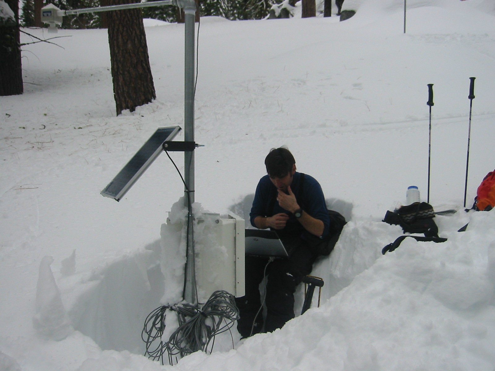
Bob Rice performing a systems evaluation and downloading data from the 10 ultrasonic depth sensors. The measurement and control system consists of a datalogger and multiplexer. The system is powered by 12 V battery charged via a 10-watt solar panel.
More 2003-04 photos